
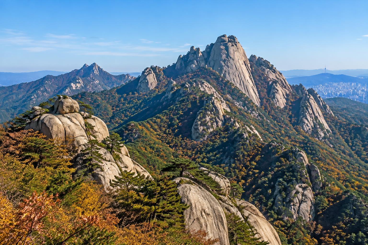
Hiking in Seoul: Bukhansan & Beyond.
From subway platform to granite summit, quiet forest trails and mountain food.
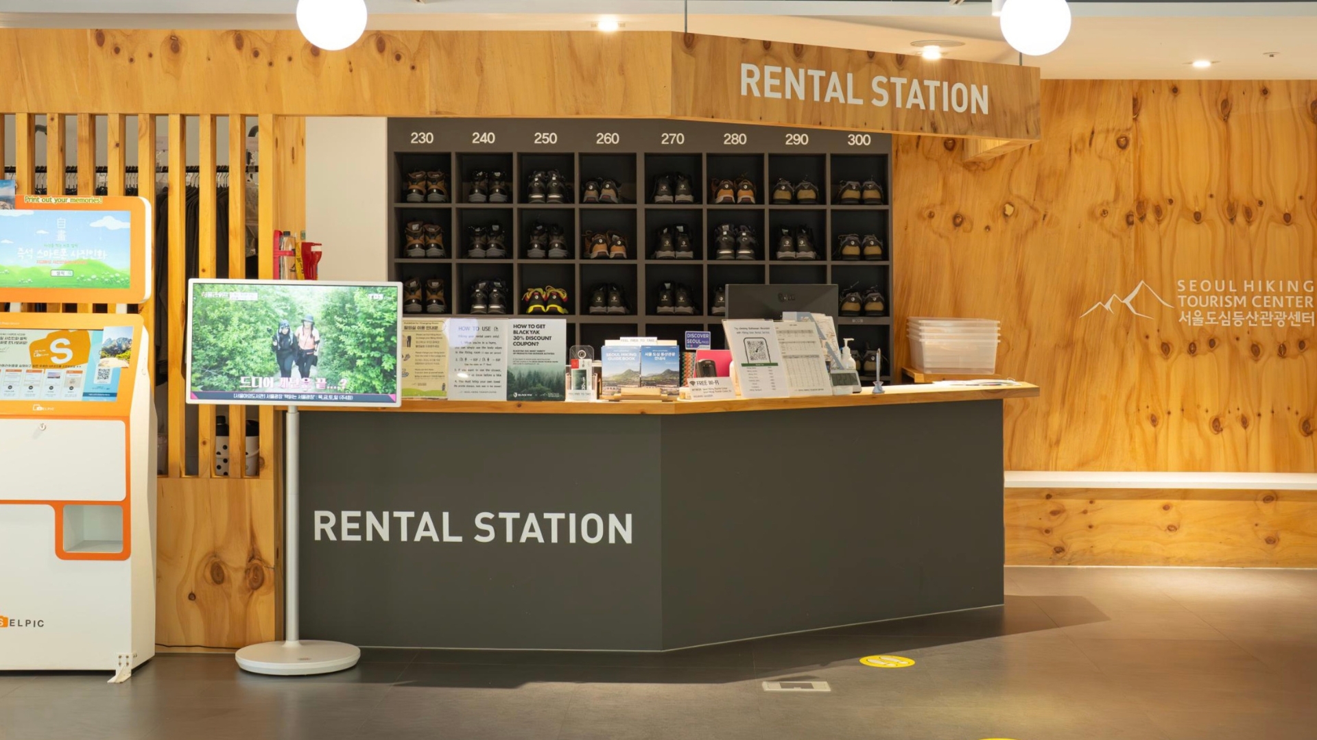
The rental-desk photograph inside this guide is Benjamin Jeary’s own picture of the Seoul Hiking Tourism Center.
Reviewed October 2026 · New online guide. General planning guidance; source types and verification limits are stated below. Not included in the original 2027 print edition; included in the complete Digital Guidebook.
- Choose the route, not just the mountain; exposed summits are advanced.
- Check KNPS closures, daylight and weather before every hike.
- The five-minute station walk reaches the centre, not the summit.
A different Seoul, one train ride away
On a weekend train you may find yourself beside older walkers with trekking poles, friends carrying lunch and hikers dressed for a much bigger day than yours. Mountains are woven into ordinary Seoul life. The pleasure is not only a summit photograph: it is a cool forest path, a greeting on the climb and a meal after your boots are back on safe ground.
Chains do not remove fall risk.
Choose lower paths or cancel.
A summit is always optional.
One national park, two mountain areas
- Bukhansan National Park includes the Bukhansan and Dobongsan areas. Bukhansan is not a single uniform trail, and Dobongsan is not a gentle extension of it.
- Baegundae (백운대), roughly 836–837 metres high, is an exposed granite summit. Its handrails, queues and steep final approach require serious judgement.
There is no summit requirement
- A lower forest walk can be a complete day. Pick terrain that matches the least confident member of your group, not the strongest.
- General difficulty labels below are route-choice guidance, not a guarantee of accessibility, current opening or safety. Turn back without embarrassment.
Rain, ice and strong winds can make exposed rock dangerous. Do not treat Baegundae’s chains as a beginner attraction; choose a lower outing when conditions or experience do not fit.
The Ui–Sinseol approach, without the confusion
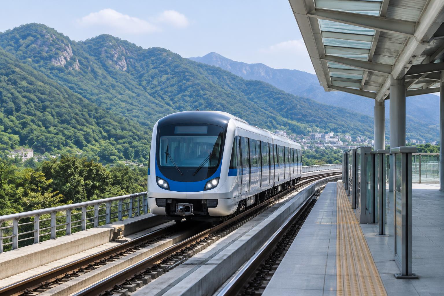
The 우이신설선 (Ui–Sinseol Line) makes the Ui side practical from central Seoul. Transfer at Sinseol-dong, Bomun or Sungshin Women’s University, then take the train north to Bukhansan Ui (북한산우이), the northern terminus. Exit 2 is the official starting hint for the tourism centre, not a claim that the mountain starts at the station.
- 1Sinseol-dong신설동Lines 1 / 2
- 2Bomun보문Line 6
- 3Sungshin Women’s University성신여대입구Line 4
- 4Bukhansan Ui북한산우이Northern terminus · Exit 2
Schematic transfer sequence only; intervening stations omitted. Exit 2 → about 300 m / five minutes → fifth-floor hiking centre. Then plan the separate trailhead approach.
Your first useful stop
- 5F, Gwangnim (Gwanglim) Building, 52 Samyang-ro 173-gil, Gangbuk-gu, Seoul. About 300 metres / five minutes from Exit 2, according to Visit Seoul. Look for the fifth-floor centre, not the separate KNPS Uiryeong support centre.
- Generally Tuesday–Sunday, 09:00–18:00; closed Mondays and on Seollal and Chuseok according to the newer visitor page. Call 1533-2608 to confirm holiday arrangements.
Advice before equipment
- Ask for route maps, multilingual advice, current trail conditions and the exact entrance and return route. The centre describes rental equipment, storage/lockers and a visitor lounge; availability and rental terms need checking.
- The official 2026 tourism listing says a small equipment-rental fee applies for foreigners. Do not rely on older “free rental” descriptions; confirm cost, deposit, ID, sizes and return deadline directly. Admission to the centre is listed as free.
Allow substantial additional travel from the centre to your chosen trail entrance and summit. A taxi or walking approach can change the day; ask where the actual trail begins and what remains after the train.
Which hike fits today?
Select the kind of day you actually want. Every suggestion needs the current park notice, appropriate footwear and a realistic return plan. Route names in Korean help you compare signs and ask the centre for advice.
Beginner-oriented lower section
Lower Sogwicheon valley · 소귀천
Choose a short forest outing rather than committing to a summit. The lower valley still has uneven surfaces; agree a turnaround point with the hiking centre and check the current access notice. Do not continue uphill simply because other hikers do.
Check official informationUiryeong: a forest walk with an entry system
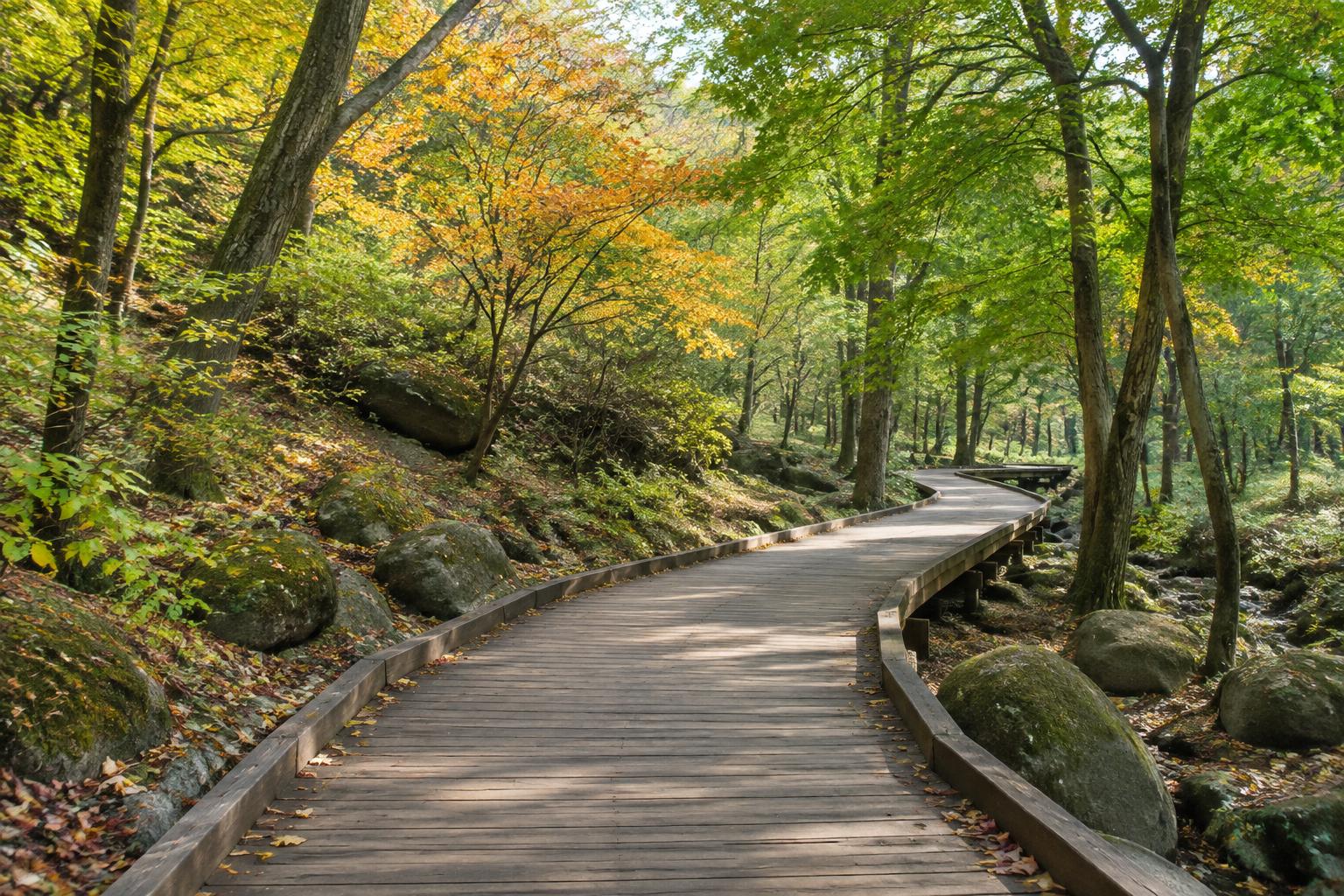
우이령길 (Uiryeong-gil) offers a quieter forest-road style outing between the Ui and Gyohyeon sides. It is not an always-open shortcut through the park. Check the current KNPS service guide, the reservation calendar, weather closures and which entrance your booking or walk-in arrangement uses.
Check before travelling
- The October 2026 review of KNPS guidance distinguishes weekday walk-in access from reservation requirements on weekends and holidays. Operating arrangements and seasonal entry cutoffs can change; the live notice controls.
- Use the foreign-language reservation route when available. Save your confirmation and bring any identification required by the current system. Do not assume a same-day place.
Plan both ends
- A forest road still involves distance and an approach. Confirm whether you will return to the same entrance or finish at the opposite side, then save the bus or rail connection.
- The KNPS Ui Uiryeong support centre is a separate park facility, not the fifth-floor Seoul Hiking Tourism Center. Do not navigate to one expecting the other’s rental desk.
Five other mountains, five different days
Seoul’s smaller or more central hills can fit a shorter outing, but their names do not promise easy terrain. Choose a specific lower route when you want a modest day; summit paths can be rocky, steep and crowded.
Inwangsan · 인왕산
- City-wall scenery and a close-up view of Seoul’s roofline. Start by comparing approaches around Gyeongbokgung or Dongnimmun stations; stairs and rocky upper sections still demand care.
- A wall-side walk and a summit ascent are different commitments. Check wall access and choose a descent before heading up.
Achasan · 아차산
- Han River viewpoints and lower walking options. Achasan Station on Line 5 is a useful starting search, not the trailhead itself.
- Ask for the park entrance and choose a lower turnaround if you do not want a longer ridge walk.
Ansan Jarak-gil · 안산 자락길
- A forest/boardwalk option around Ansan, useful for a gentler outing. Search the official Jarak-gil entrance and compare access from Dongnimmun or the Seodaemun area.
- Boardwalk does not guarantee a step-free journey from every station, nor that every branch path is open. Check the approach if mobility is important.
Dobongsan · 도봉산
- Dobongsan Station serves Lines 1 and 7. Save the actual park entrance separately from the station.
- The Sinseondae (신선대) summit approach is rugged and exposed; choose lower paths if a steep granite day is not suitable.
Gwanaksan · 관악산
- Gwanaksan Station on the Sillim Line gives a useful southern-Seoul starting point; look up the Seoul Hiking Tourism Center Gwanaksan branch for local advice.
- The summit is challenging, not an automatic continuation of a lower valley walk. Verify the chosen entrance, course and return transport.
Six checks before you follow a blue dot
KNPS is the first stop for park regulations, courses, entry times and closures. Naver Map and Kakao Map are useful for the station, road approach and restaurant, but a suggested walking line is not permission to enter a trail. Tranggle and Ramblr can offer user-contributed tracks; these may be old, off-route or unsuitable for current weather.
- 01Pick a named course
Read the official description. Check start and finish, direction, difficulty and whether the distance is one-way or for that specific whole itinerary.
- 02Check the live notice
Look for closures, fire-prevention restrictions, weather warnings, reservations and seasonal entry cutoffs. Never bypass a barrier to match an app.
- 03Save Korean entry & exit names
Save the ranger/support point or trail gate, not just “Bukhansan”. In Naver/Kakao compare the Korean name and road approach with the official course.
- 04Separate rail from hiking
Record station exit, local bus/taxi/walk and the true trailhead. The five-minute centre walk is not a mountain-route duration.
- 05Download & share
Save a map or screenshot for offline use, with emergency markers and your planned return. Share the route and a check-in time with someone.
- 06Set a turnaround
Leave time for descent, queues, rests and last transport. A published average is not your pace; change the plan if the slowest person, weather or daylight requires it.
One published itinerary, not every Baegundae hike
Visit Seoul’s “Baegundae–Ui Gugok Trail” is a specific advanced itinerary, including Yeongbong and a return via Yongammun and Doseonsa. Its published 9.98 km total and 4 hours 20 minutes average belong to that course alone. They are not a one-way station-to-summit distance, a universal round trip or an achievable target for every visitor.
Do not mix route figures
- A shorter course beginning at a higher support point excludes your journey there. A longer loop can add climbing and a different descent. Compare the same start, end and direction before comparing numbers.
- There is no generated GPS track or promised total time here. Use the official course map and ask for a current route suited to you.
Carry what the return journey needs
Call 119 for mountain rescue, fire or medical emergencies. State the mountain, trail, nearest numbered rescue marker or sign, your location and what has happened. Save a location offline, but do not rely on a phone alone. If thunder, strong wind, ice, slippery rock, fatigue or failing daylight changes the risk, abandon the summit goal.
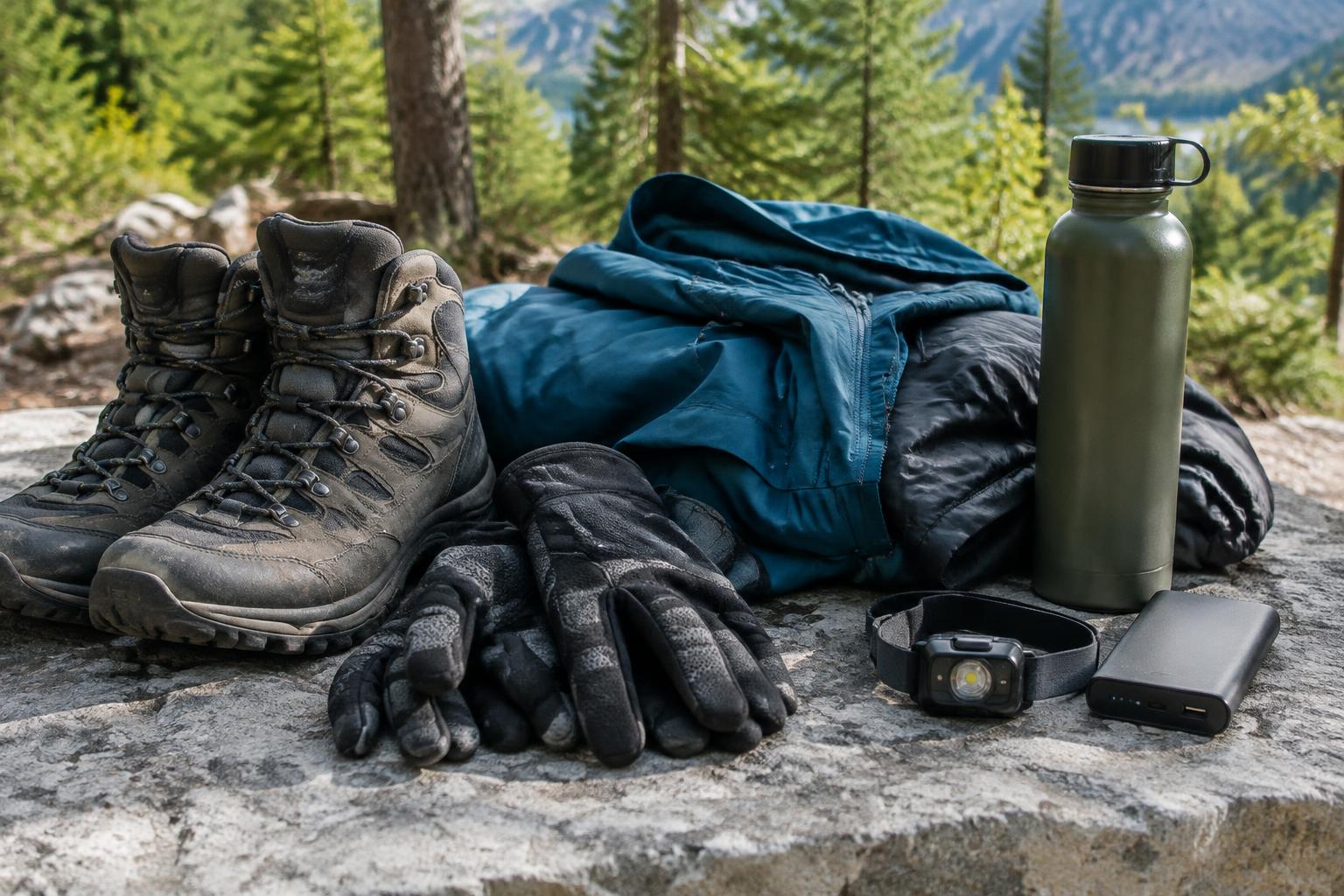
Hiking packing checklist
0 of 8 checks complete
Do not drink before or during an exposed ascent or descent. A meal and makgeolli belong only after the entire hike is safely finished, with a safe journey home. Alcohol is not appropriate on temple grounds.
Small courtesies make narrow paths work
A quiet 안녕하세요 (annyeonghaseyo, hello) is enough when passing. 조심하세요 (josimhaseyo, please be careful) can be a kind warning. On narrow paths, communicate, pause at a safe wide point and let others pass without pushing toward an edge. Do not race a summit queue or overtake on chain sections.
Move with patience
- Keep voices and music low. Give climbing or descending hikers space; do not stop for photos where people need handrails or a safe foothold.
- Stay on marked open paths. Cutting corners damages vegetation and may lead to hazardous terrain. Follow ranger instructions and closure barriers.
Leave nothing behind
- Carry out food wrappers, tissues and fruit peel. Do not feed wildlife. Toilet access is limited; plan around official facilities.
- Fires and cooking are restricted in national parks; do not bring a stove or light a fire assuming a picnic spot permits it. Follow current park rules.
Gimbap on the trail; pajeon after the descent
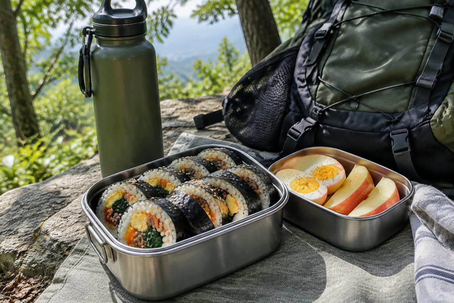
김밥 (gimbap), boiled eggs and fruit are practical packed food when you stop in a safe permitted place without blocking the path. Bring your own water. Mountain restaurants after the hike offer a different ritual: rest, share something warm and let the day settle.
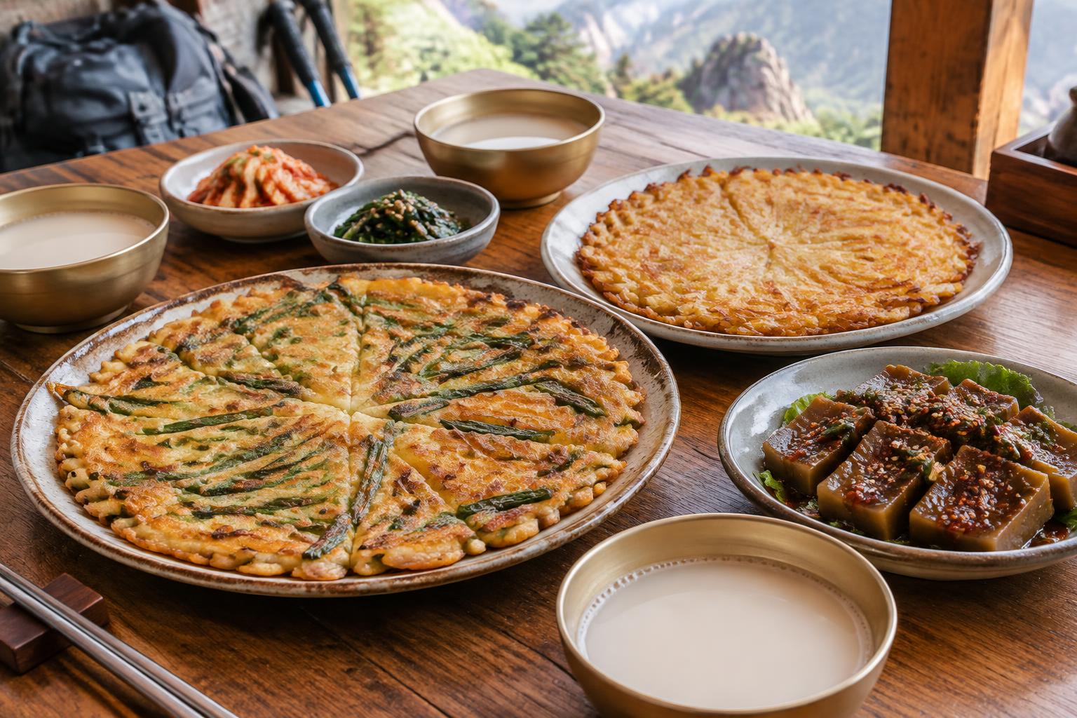
What to look for on the menu
- 파전 (pajeon): scallion pancake; 감자전 (gamjajeon): potato pancake; 순두부 (sundubu): soft tofu, often in a stew; 도토리묵 (dotori-muk): acorn jelly. Recipes and ingredients vary.
- 막걸리 (makgeolli) is a milky alcoholic rice drink, not a sports recovery drink. It is optional, only after safely completing the hike, and never for someone driving or needing to continue on hazardous terrain.
A gentler finish
- Tea or coffee works just as well. Confirm ingredients for allergies and do not presume tofu dishes or side dishes are vegetarian.
- Use current Naver/Kakao listings for restaurants near your actual exit, not an unrelated entrance across the mountain. No named restaurant, live price or menu is promised here.
Combine a mountain with a little culture
These are planning themes, not timed itineraries. Confirm the temple’s permitted visitor areas, park opening and any programme reservation first. A cultural visit does not make a difficult approach easy.
Jingwansa + Eunpyeong Hanok Village
- Make the temple your anchor, enjoy the nearby hanok neighbourhood respectfully and choose only a modest open forest walk. A useful first mountain-culture day without a summit target.
Ui train + a chosen Bukhansan course
- Start with centre advice, then commit only to a confirmed route matching your ability and daylight. Doseonsa may be part of the chosen course, but its uphill approach is not a trivial five-minute add-on.
A booked temple stay
- Reserve a suitable Geumsunsa or other official Templestay programme, confirm arrival instructions and let the programme shape the day. Do not bolt a strenuous summit onto a fixed check-in time.
Editorial guide based on official sources, reviewed October 2026. Confirm current requirements with the responsible office before acting.